Downloads GPX File | KML File | Google Maps File | OS Online route
About Thor’s Cave | Parking Location | OS Map | Current Weather
Thor’s cave is a somewhat beautiful cave half way up a tall peak that some ancient humans once called home. Surprisingly close to home, yet somewhere we had never been before. It was Also this hike that we decided to start tracking our walks and hikes and upload them via a GPX file to the site for others to use at their leisure.
One of Ray’s oldest friends was also back from working in the middle east and was desperate to see some “grass and tress!” we decided what better place than a hike around the peak district that would take us past rivers, forest and rolling hills as well as the aforementioned cave.

We started out in Wetton after finding a small car park just down the road from a church, from here we found ourselves walking through some fields with cows and sheep in them, before circling around what seemed to be the only tall hill in the area, after getting around this hill it became obvious the track was to lead the three of us up the opposite hill. At first this climb didn’t seem too strenuous, however after a few constant minutes climbing we realized it was going to be a bit tougher that we thought.
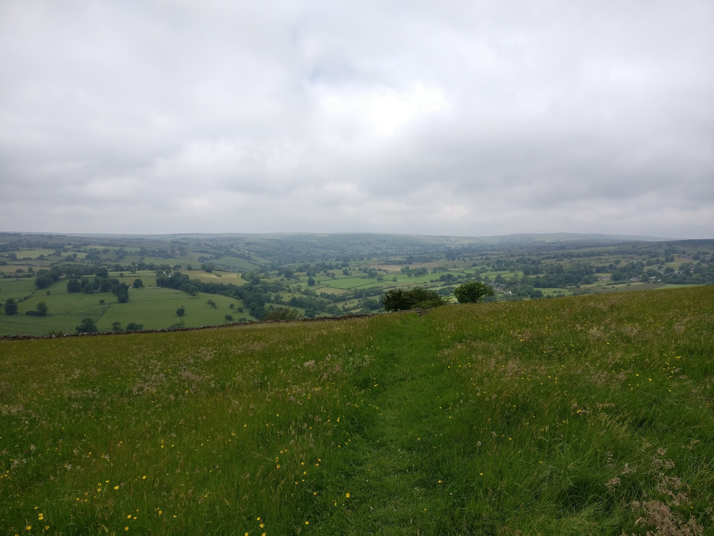
upon reaching the top of the long winding road we found ourselves once again cutting through a field, this time however we found ourselves looking into a valley that encircled Ecton. we followed the ridge of the valley round until finding a suitable place to sit and eat our sandwiches.
Once we got moving again, we continued around and into Ecton before passing back up another small hill towards Warslow. it was at the point of nearing the town of Warslow, we decided to make a turn and start to head back south towards both Thors cave and Wetton.
The map below shows how straight this part of the walk was, aside from a couple of wanders off track it’s pretty much a straight line, however it doesn’t give you an idea of both the constant change in incline, the heat that had become to bare down on the three of us or the fact at one point we had to wade through ankle deep mud…
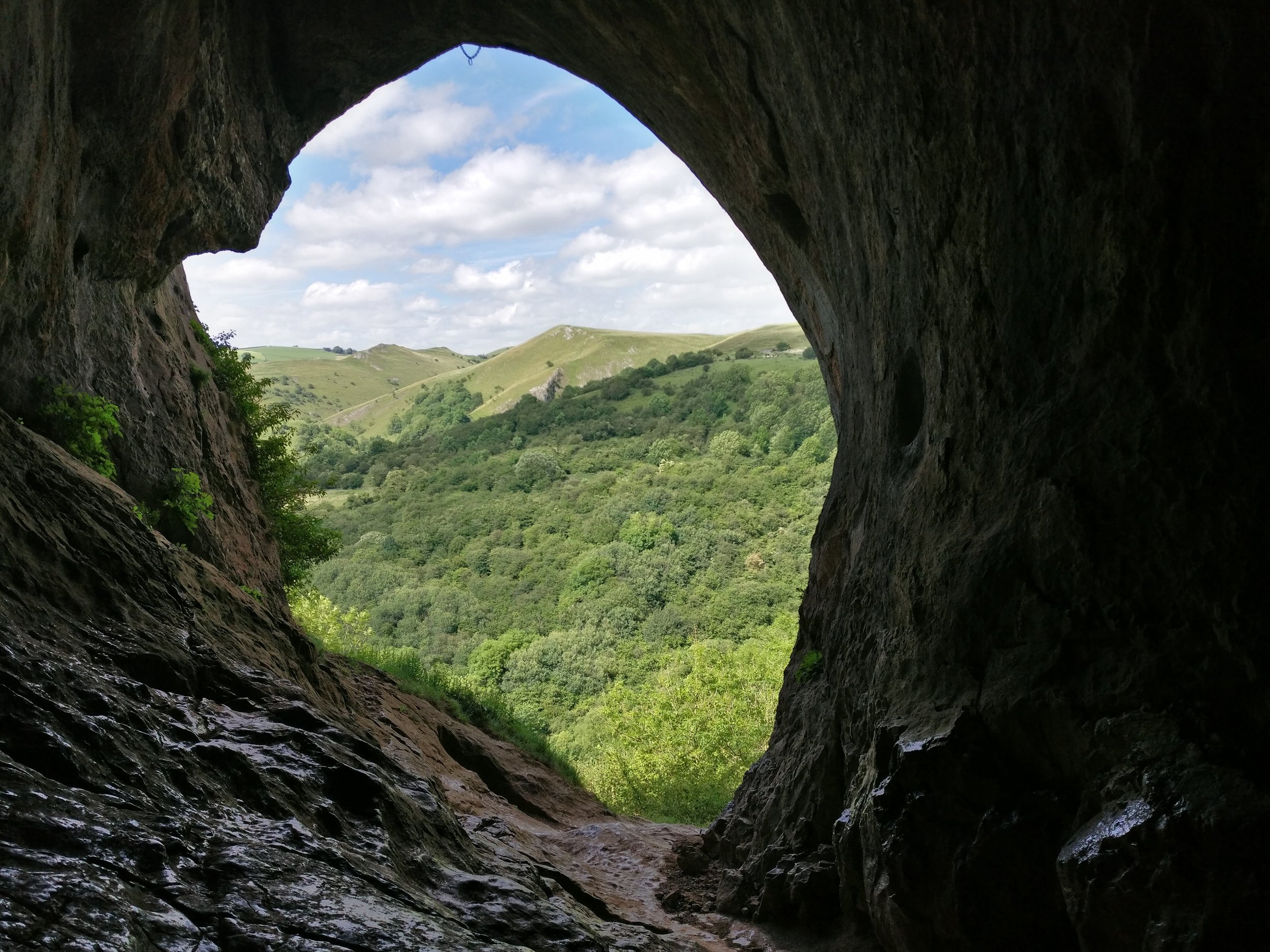
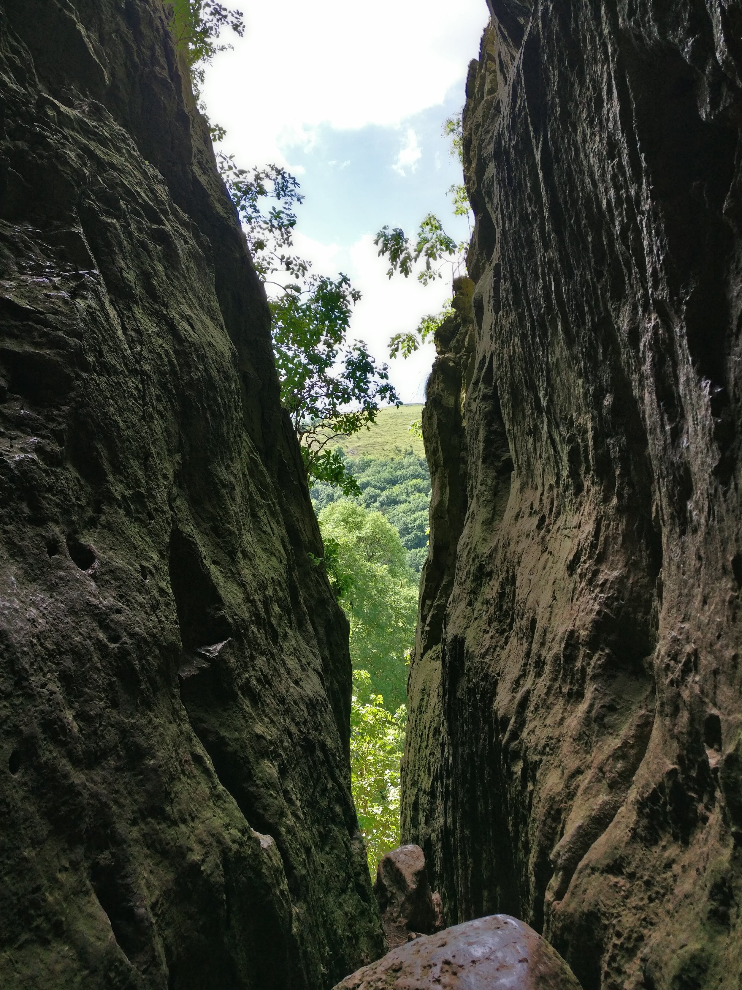
However, upon getting to the most southerly part of the route, towards Grindon we were welcomed with some spectacular views of the surrounding peaks as well as a fantasic view of Thors cave. from here we circled around until we got to the bottom of the cave where we were greeted to some informational boards about the cave, and the first actual footpath in most of the hike. a few (possibly hundred!) steps up and we reached the top where we found ourselves our awed with both the size of the cave as well as the view out across the peak district.
After spending a while taking photos and exploring the cave, we wandered out took a sharp right and continued on up the track, it wasnt long before we found ourselves wandering back into Wetton and scrambling to find the nearest pub!
it was probably our longest walk to date ( 9.04 Miles as well as most time consuming (5 hours 39 mins) however we all had a fantastic time and would definitely recommend it.