Downloads: GPX File | KML File | Google Maps File | OS online route
About Knott Rigg | Parking Location | OS Map | Current Weather
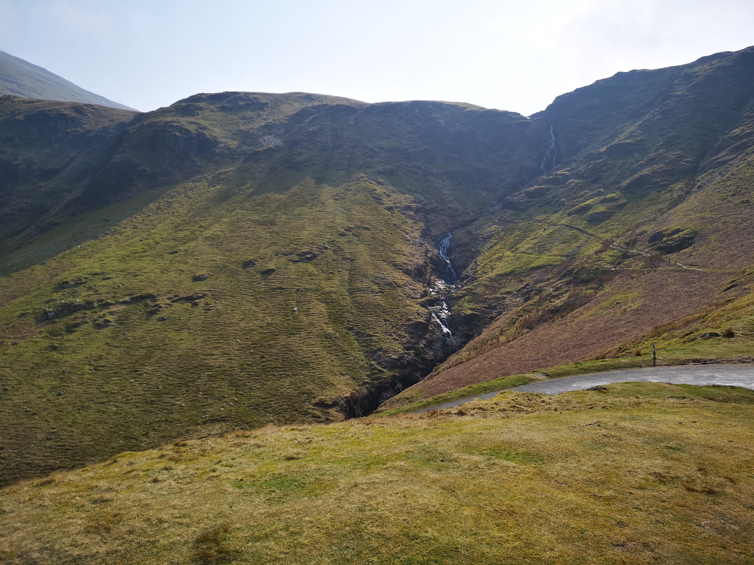
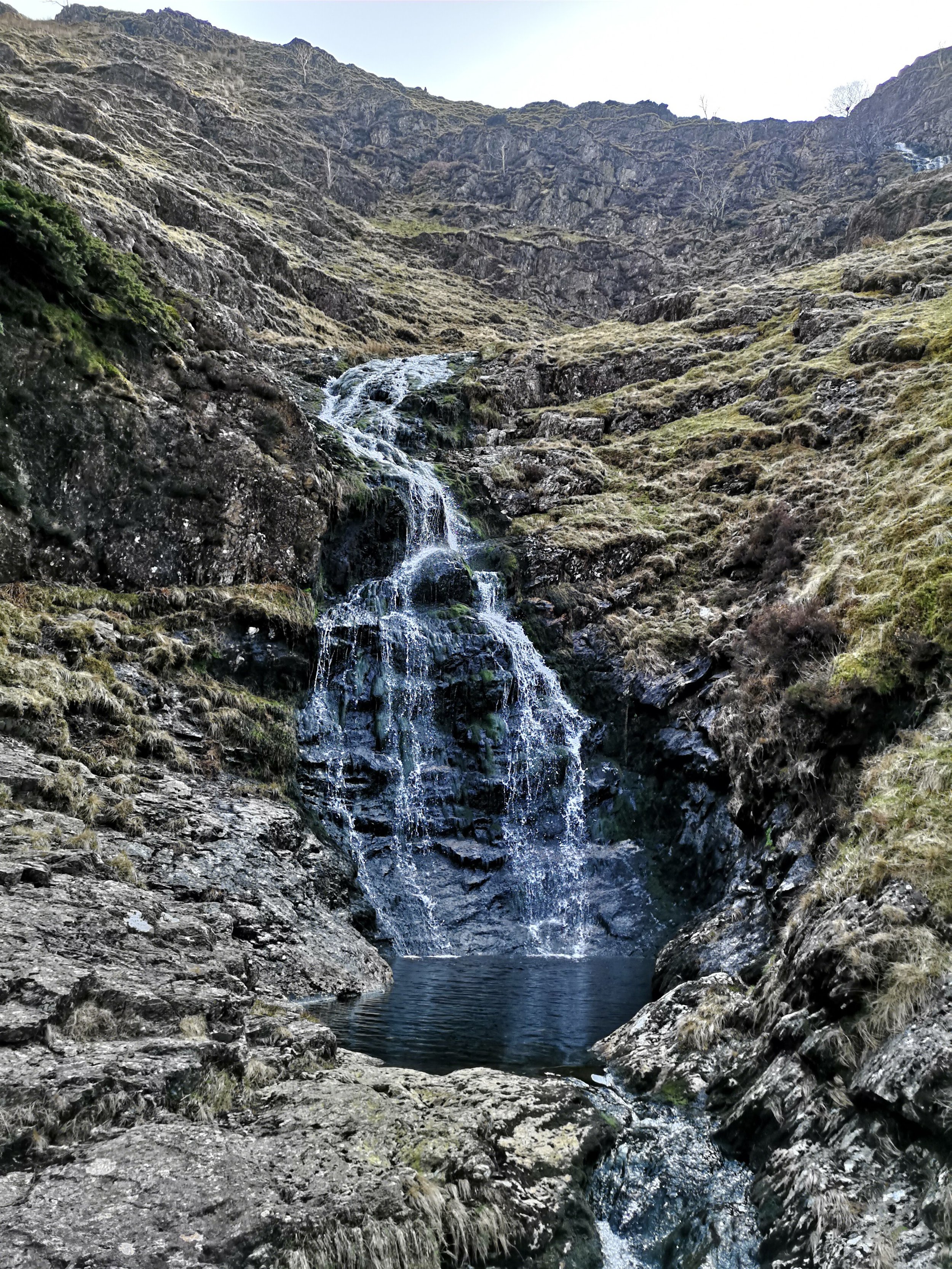
After our Buttermere walk, we had planned to head back to our log cabin but returning via a road we hadn't been through before. During the steep drive up the side of the mountain range we stumbled across a car park that we hadn't know about, this happened to be between a few peaks as well as beautiful waterfall. We stopped and checked the map where we saw Knott Rigg, somewhere we had planned on walking at some point but not this week. Looking up at the beating sun, we decided we would attempt another fell today and get up to the top of Knott Rigg.
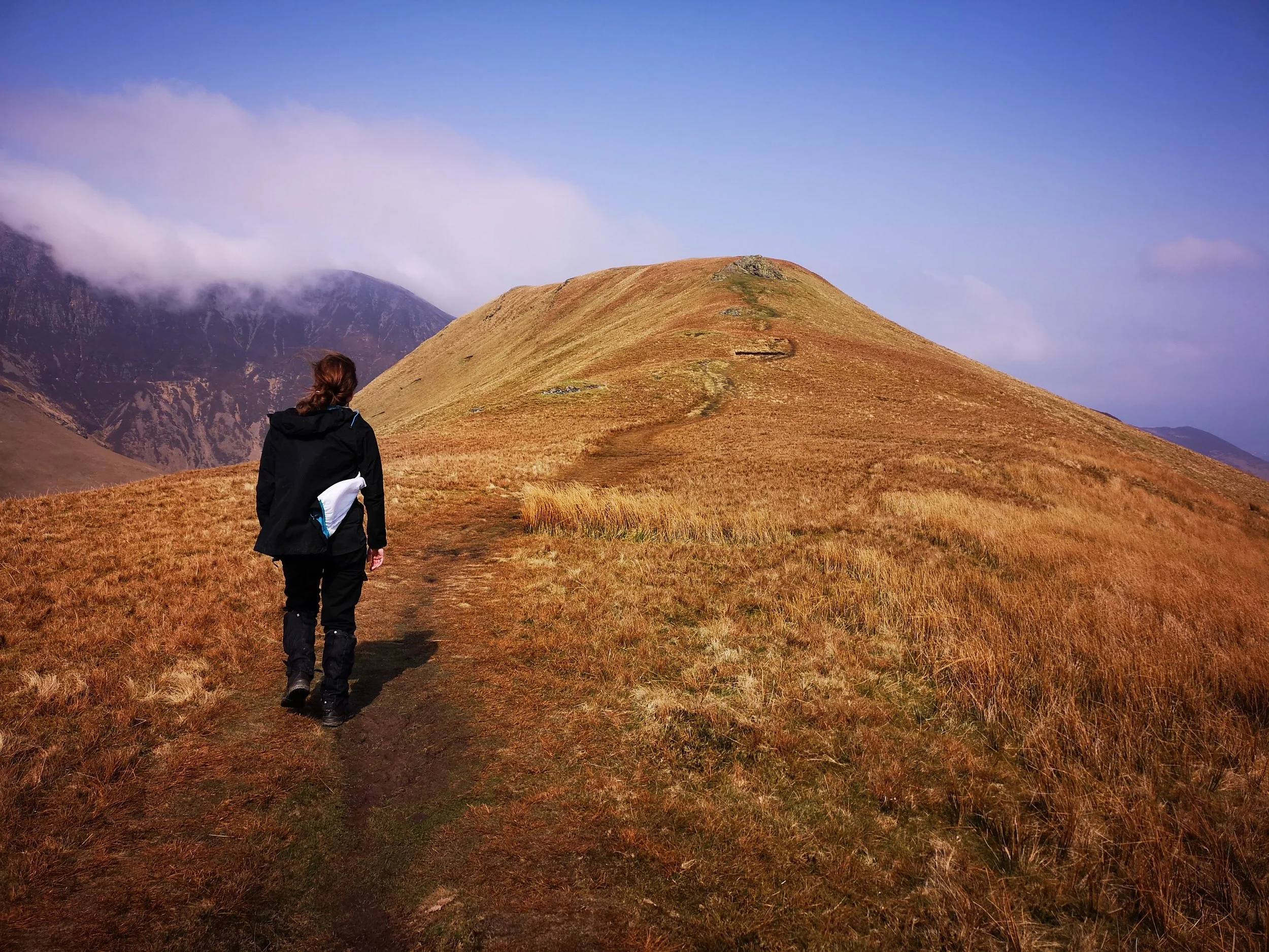
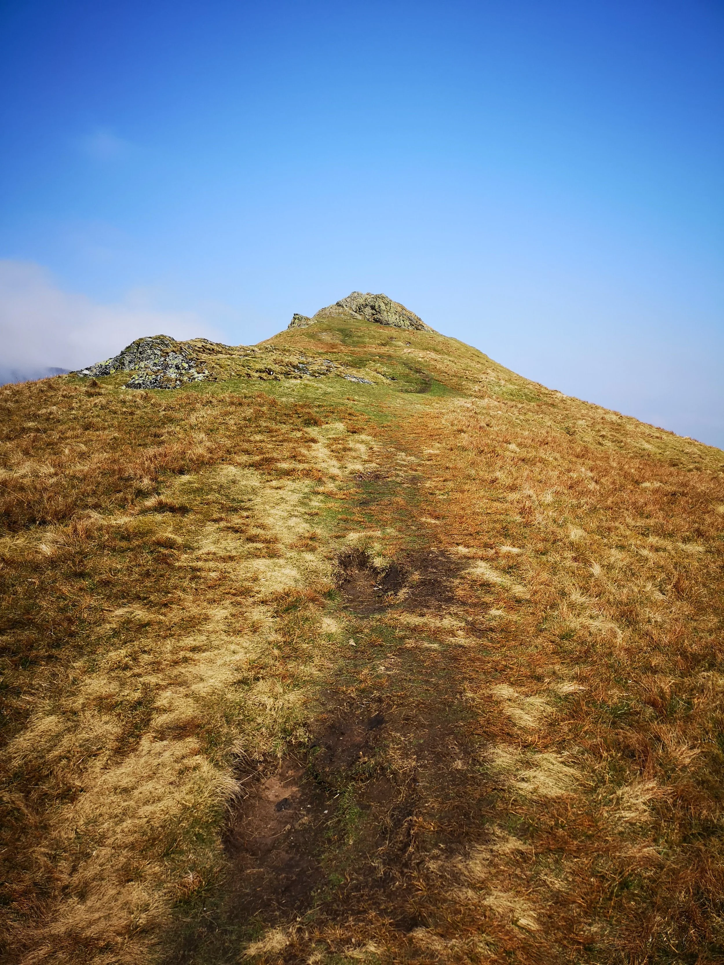
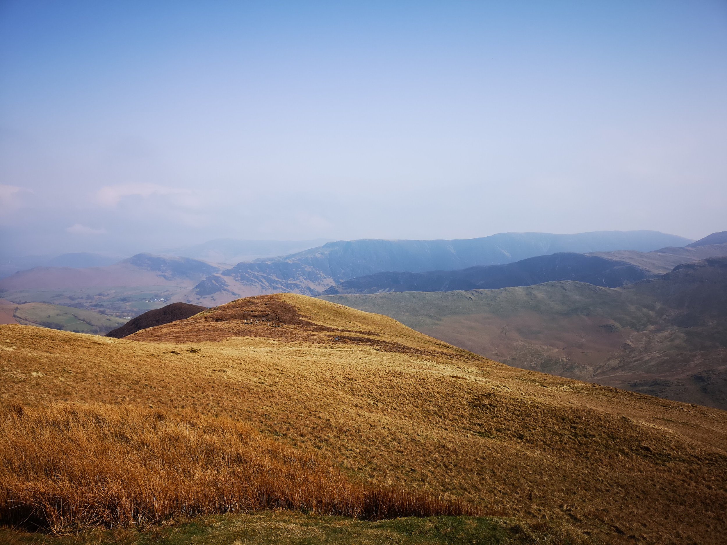
We headed up from the car park whereby the first third of the walk is over grass, with a few foot holes in, that isn't too steep and allows you to gain ground quickly. Eventually nearer the top there are rocks poking out of the top you need to navigate around, however none of this is too difficult as there is a clear path at every point. When we reached what we at first thought was the peak (the top we could see from the road) we realised we had done most of the climbing in terms of height, but there was still a good stretch of ground to cover to get to the peak.
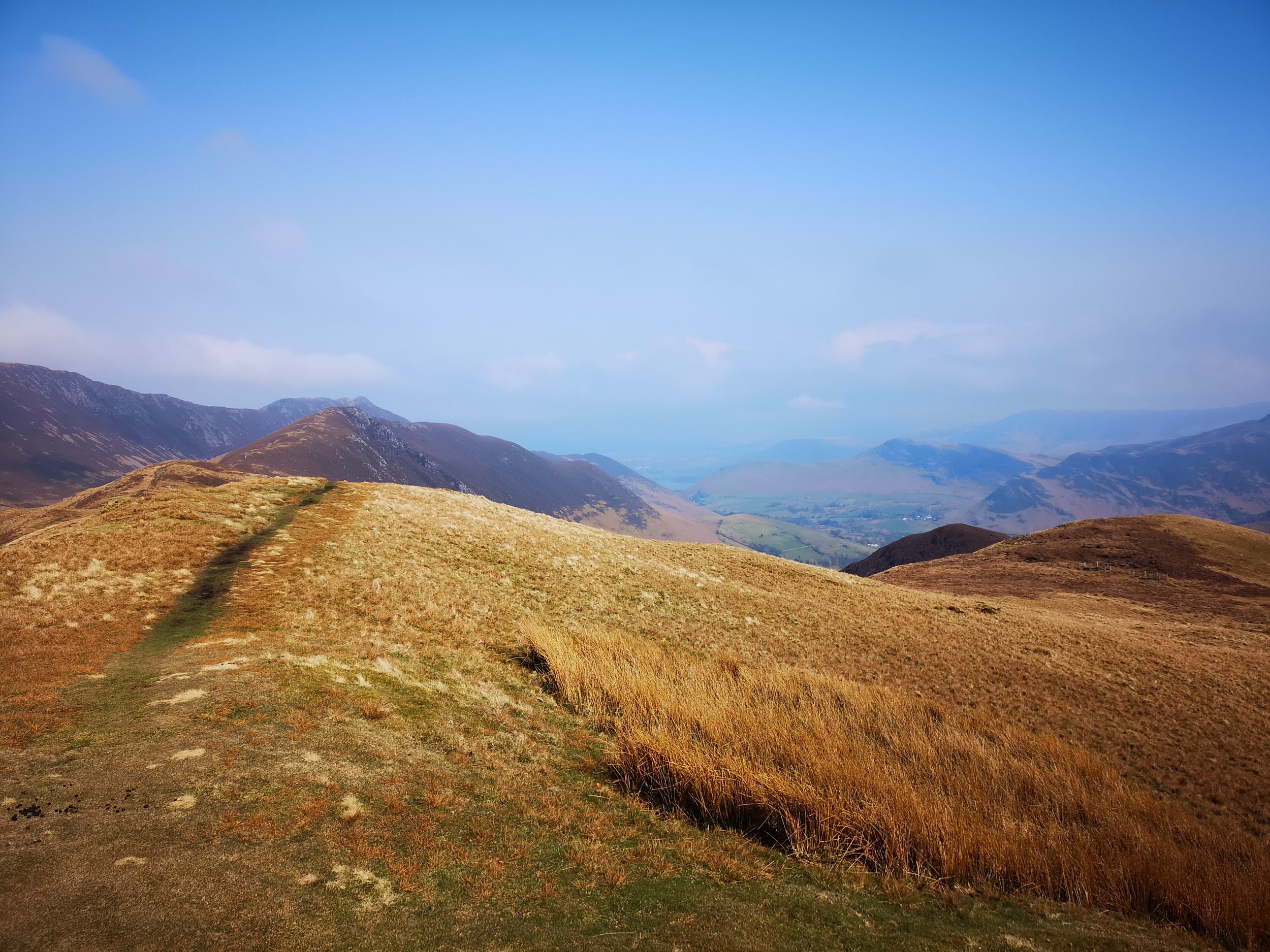
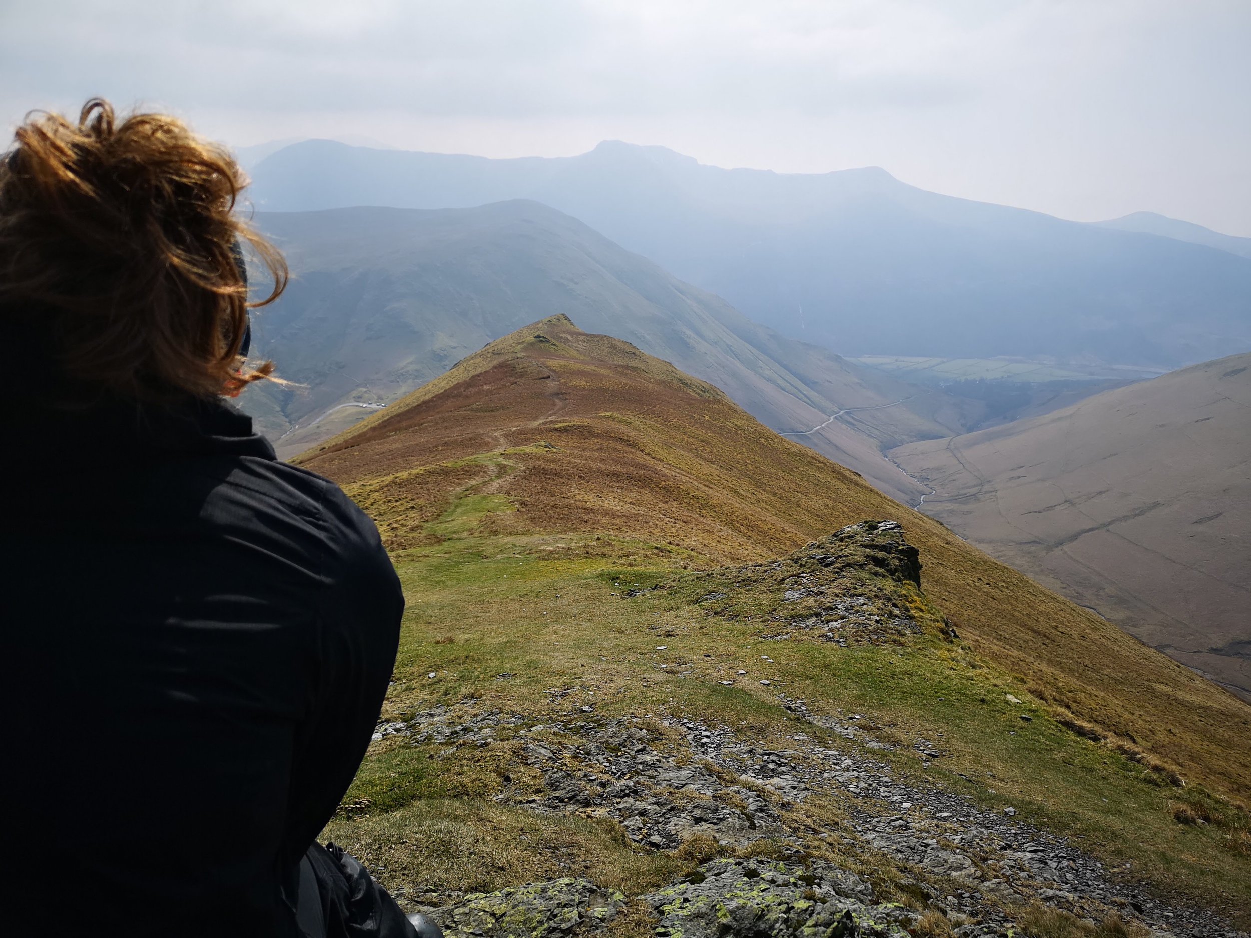
Along this point of the walk, we found a few boggy areas, luckily, they weren't very big so we skirted around these. Eventually we followed the path's across and ended up at the top of Knott Rigg. The views are fantastic, not only do you feel in the middle of nowhere with no road or house in sight, but also due to the mountain chains running in parallel to Knott Rigg you really feel in the middle of the peaks. We stood for 5 to 10 minutes looking at the fells, pointing out ones we knew and grabbing the map to see what ones we didn’t. It was fantastic and with the sun beating down it made for one of the best peaks.
Eventually, we pulled ourselves away from this and headed back to the car. Again, it's not too difficult to get down, following the path easily while the drop back into the valley isn't too steep at all. Eventually we made our way back own to the car park and saw the waterfall again. Checking the time (we had a meal booked for our evening meal) we decided we had enough before needing to move on so headed to the waterfall.
There are two paths that take you to the waterfall, although the top view is the obvious choice the bottom route shows a much better view of the fall itself and even has an area where you can scramble over the rocks and stand in the middle of the waterfall. It is one of the most beautiful waterfalls we had seen, a bit of googling allowed us to discover this was Moss Force and it is somewhere I suggest you definitely visit if you are in the area. It is beautiful and has a cool clean water flowing through it.
All in all, this seems like a lucky fell, we had failed earlier in the day and getting some height due to my boots rubbing and had only happened upon the car park as I was looking for a different way to drive back to keep the drive enjoyable. We really enjoyed this however, the views from the peak on a clear day like today was stunning.