Downloads: GPX File | KML File | Google Maps File | OS online route
About Chrome Hill | Parking Location | OS Map | Current Weather
We have had this walk on our to do list for a few months before we got the chance to spend a very sunny Sunday here. We had seen Chrome Hill with Parkhouse Hill, known together as the Dragon’s Back, from a distance and decided it’s uniquely shaped hill was too good to pass up. We had read that the limestone reef knoll, known as Chrome Hill, has only recently become legally walkable (since the Countryside and Rights of Way Act in 2000) so planned our route thoroughly. After all, we were walking on private land via a concessionary footpath to get to this hill.
We started off in Longnor. We had initially planned this walk from Hollinsclough, but we opted to go a little further afield for longer walk and easier park.

There is a car park in front of Longnor Craft Centre and Coffee shop, but we parked on Church street, situated behind. We left Longnor by walking along Gauledge Lane and headed to Hardings Booth. From here, we took Ball Back Lane, where we met the first of the farmers on quad bikes! Taking the footpath to Limers Rake, we met a road closed sign in front of large white boulders. These were put there to stop the desecration of the footpath my motor bikes, 4 x 4s and probably even the quad bikes that seem so rife here too. Climbing round the boulders, we followed this rocky and worn path until it rolled us out near Hollinsclough Methodist Chapel.
Hollinsclough was saturated with walkers, we were thankful we didn’t have to fight for a parking space here in this beautiful little village. From here we ventured down to a lovely gated bridge over a brook, and made our way up to Booth Farm, where we met another Quad Bike loving farmer. We skirted round Hollins Hill to Stoop Farm. This is where the path becomes concessionary. As we walked though well marked gates and fields full of new-born lambs, we were conscious of closing gates behind us and sticking to the path. Nearing Chrome Hill, the path descended gradually, setting us up for a good steep hike to the top.
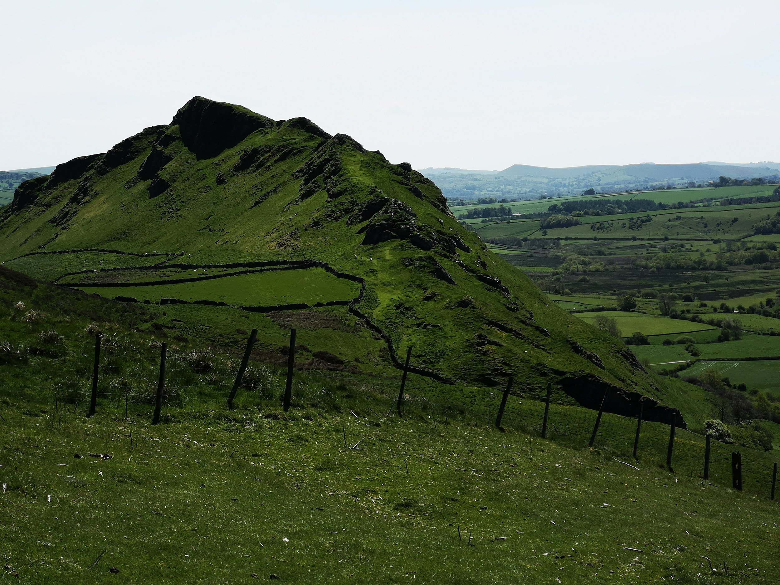
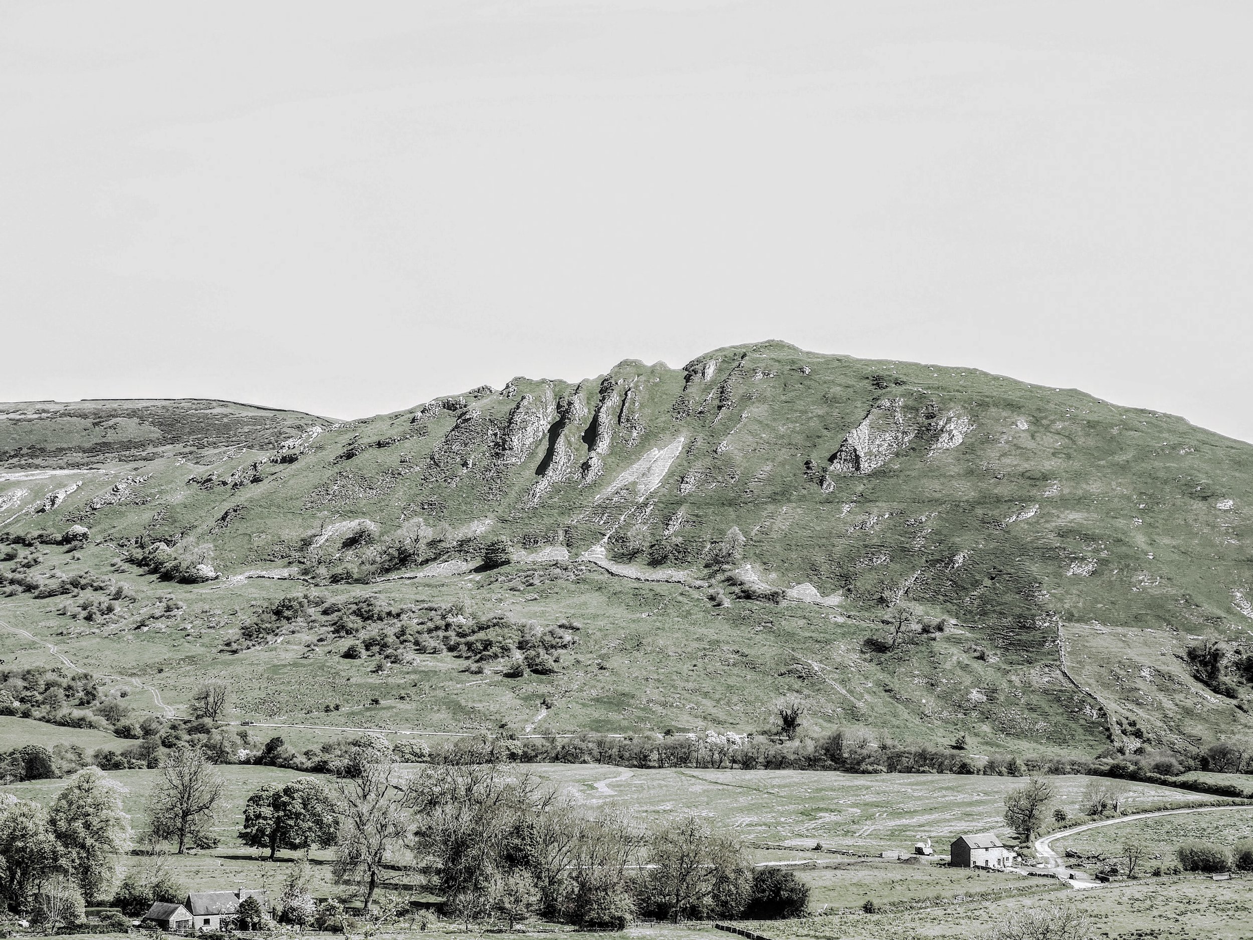
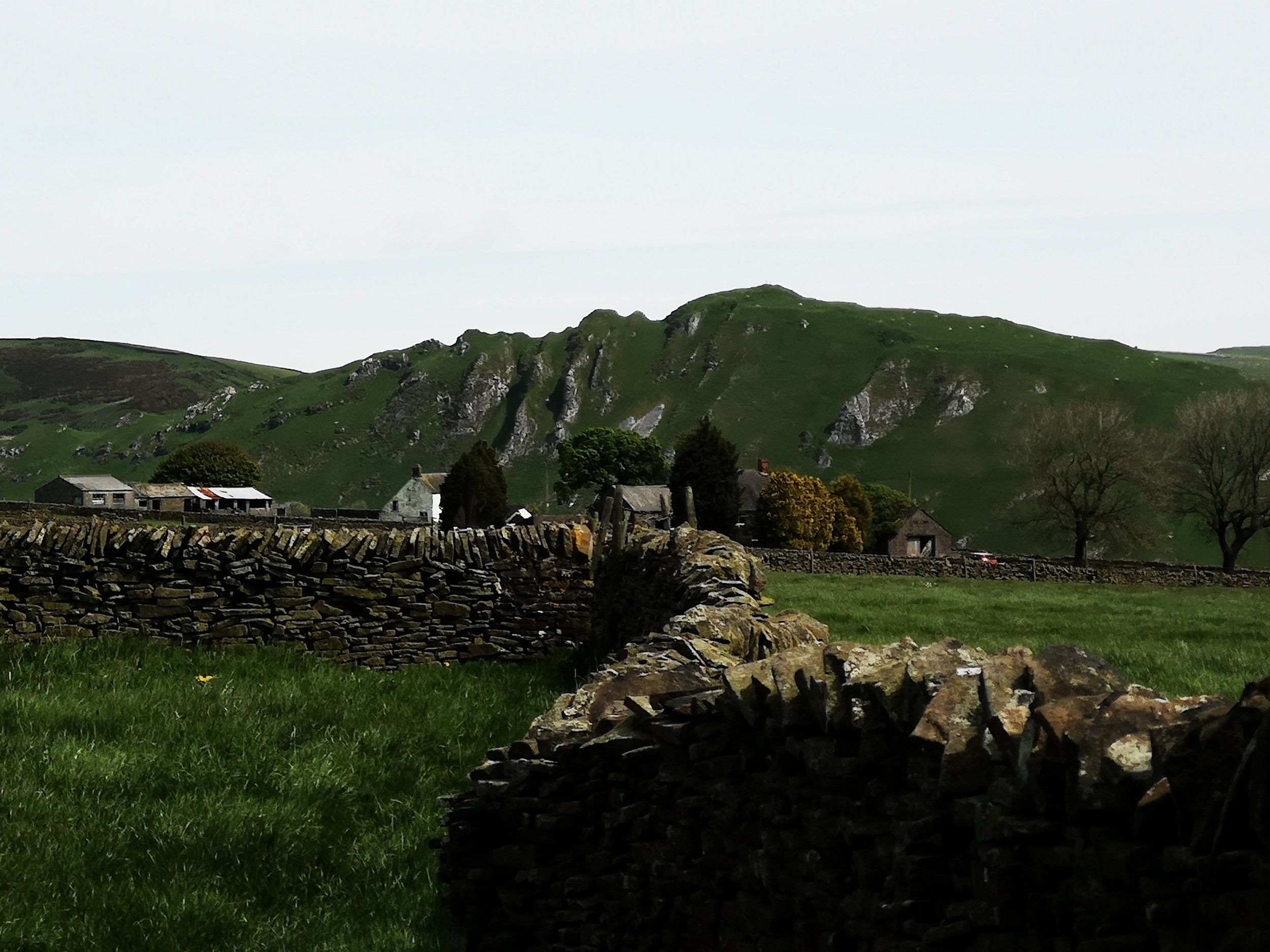
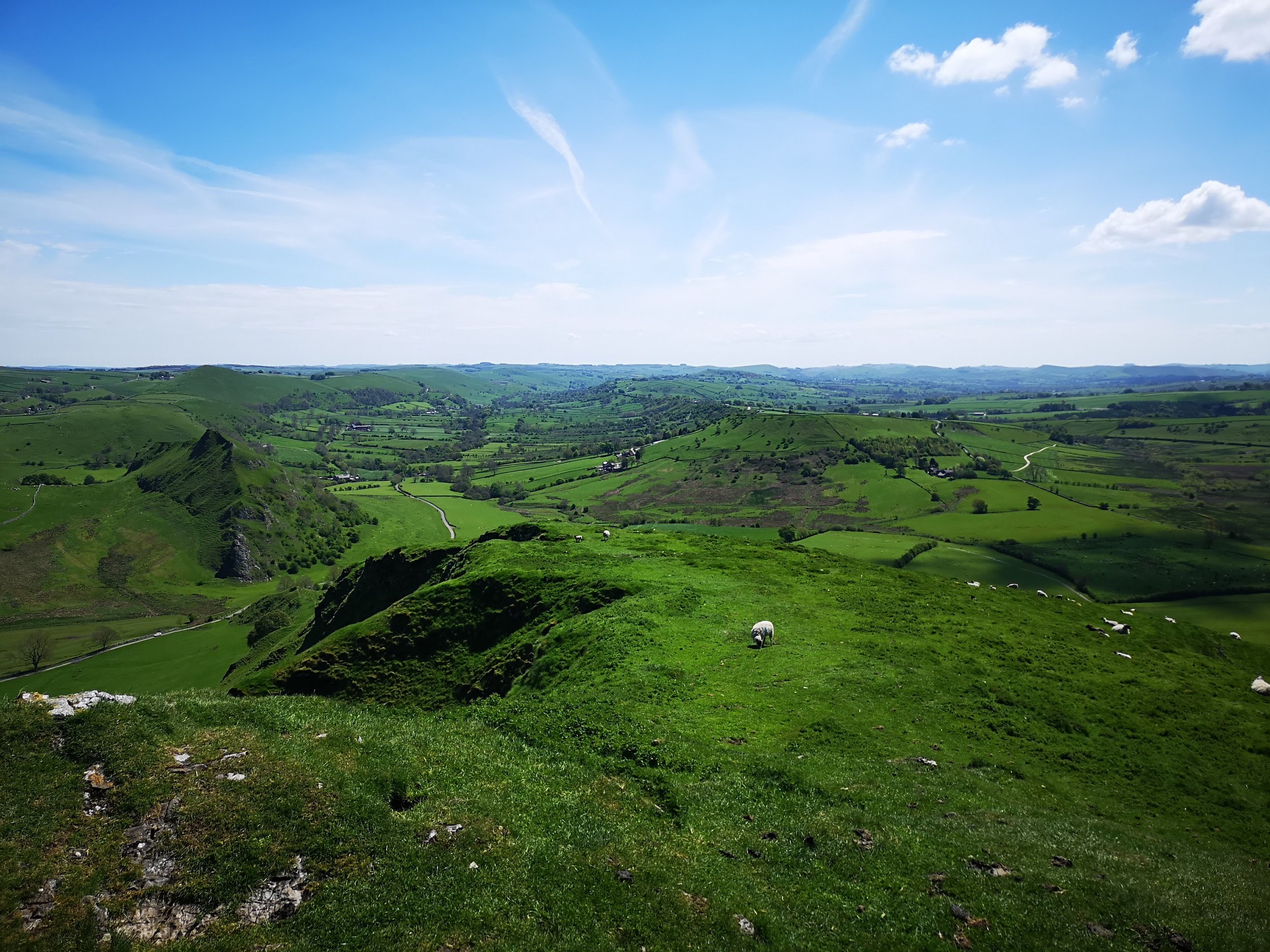
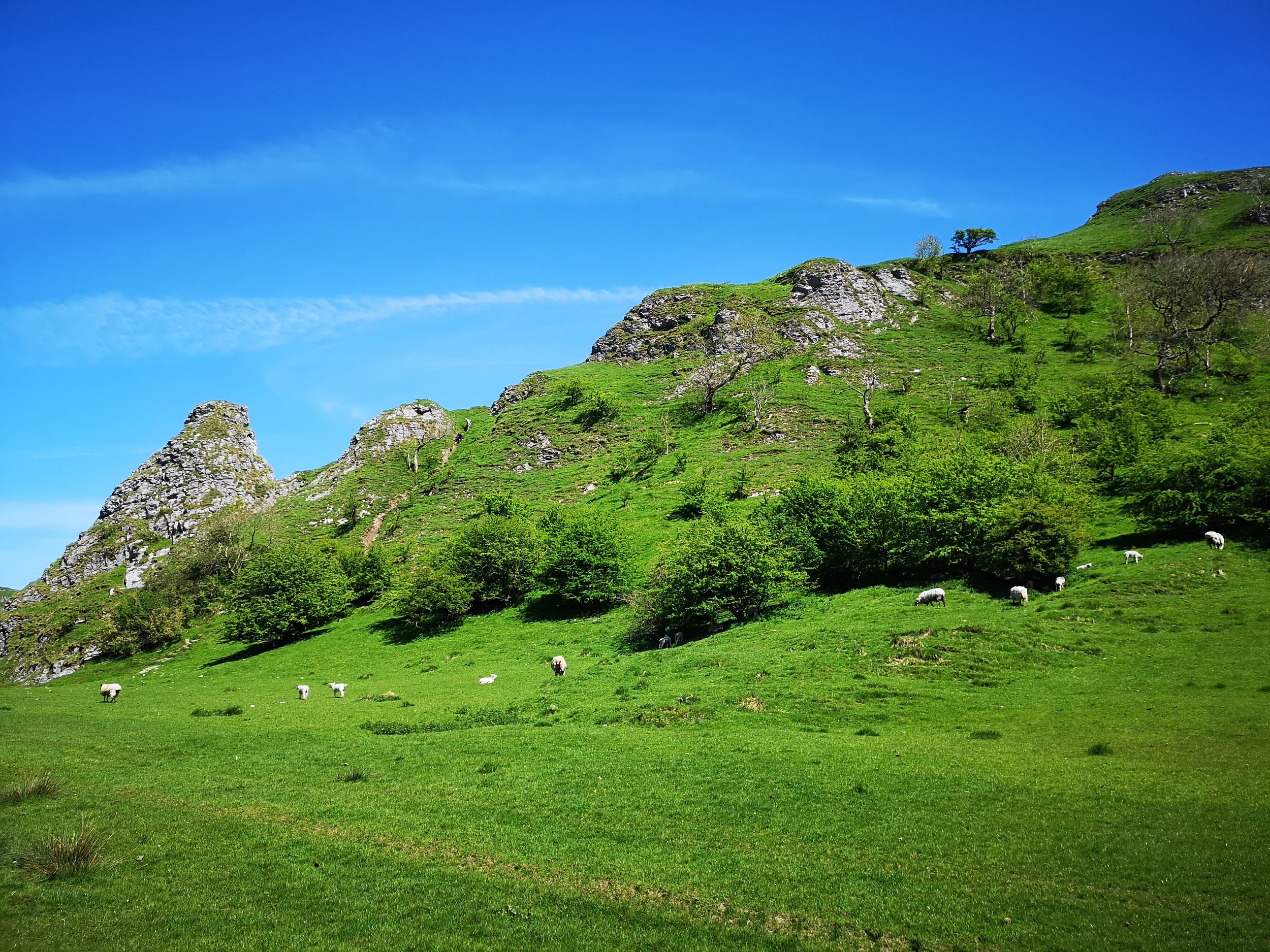
The view from this side is most beautiful and interesting. The deep pale gauges in the rock streaming down the hill give sharp relief to the dark shadows which form underneath the stooped, broken summit. The other side of the hill shows its greener smooth curved back bone. Still as fierce, almost as its nickname suggests, a felled dragon, lying wounded but still dangerous on the mountainside. On the whole, a startlingly different hill from every view point.
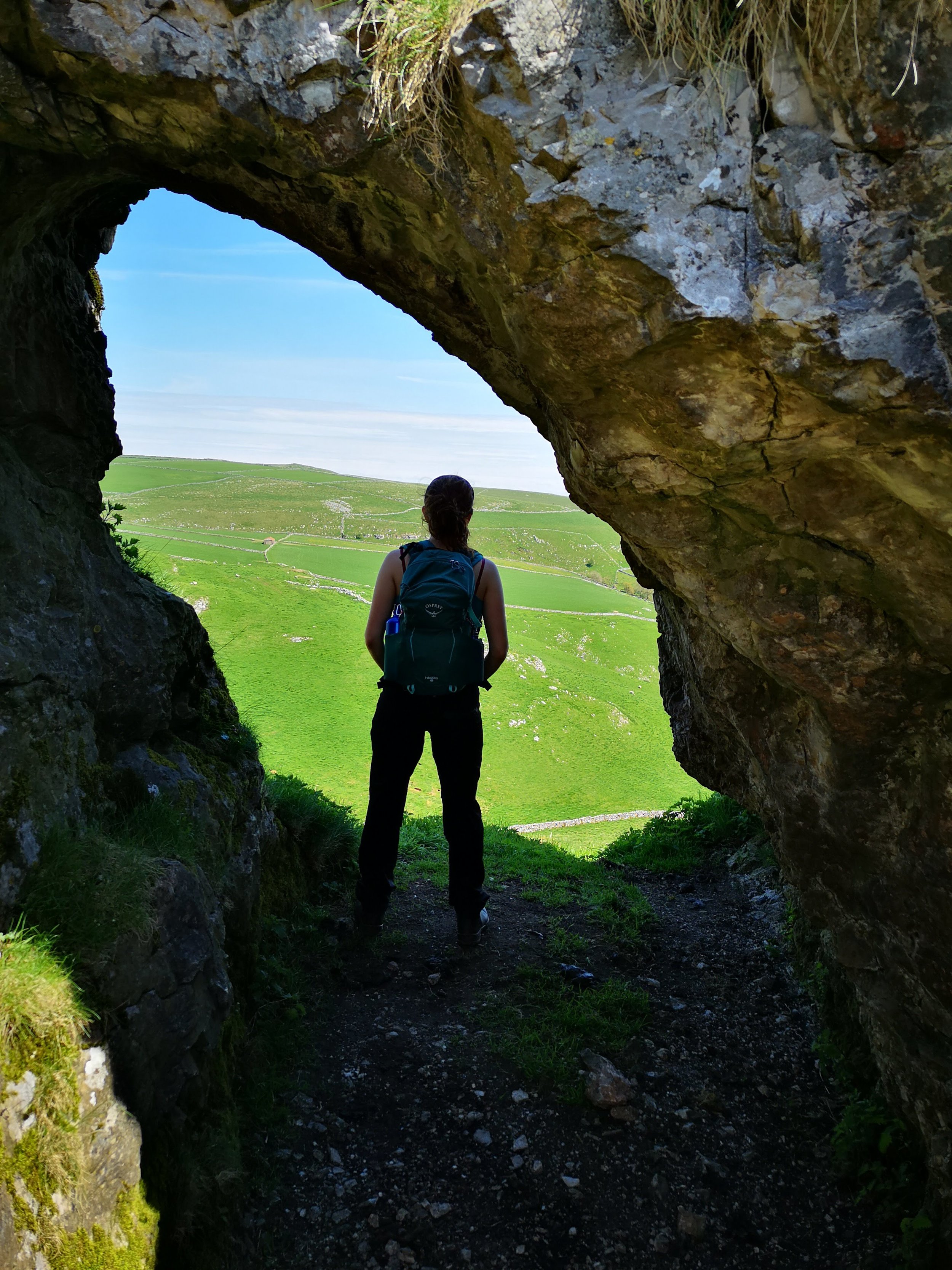
Even on a day as beautiful as this Sunday, there was still some gusts at the top of the hill with a sheer drop to the left. Much care needs to be taken. Despite this, we enjoyed the path greatly as it weaved its way between the rocky outcrops on the hill. Hidden away near the summit, was a wonderful archway of stone which we had no idea was there! Peering through it, it gave great views of the landscape beyond.
Descending from Chrome Hill, we had good views of the steep walk up and down Parkhouse Hill. We are saving this part of the Dragon’s Back for a later day. At that moment in time we were put off by some walkers straining and struggling on this hill as we merrily walked round it to Buxton Road. From there is was a lovely meandering walking up a road and down a bridle path, so chilled and peaceful, Dan managed to trip over nothing while lost in his own thoughts. The last ascent up the steep path, taking us back to Longnor, was completely involuntary on all accounts that our knees were concerned. But a cuppa and a cake in the Craft Centre and Coffee shop gave us some cooling respite from the sun.